By: Nana
Appiah Acquaye
The European Space Agency’s
(ESA) Copernicus Sentinel-3C satellite has delivered its first thermal images,
demonstrating its capabilities in measuring land and sea surface temperatures
and monitoring wildfires.
Simonetta Cheli, Director of
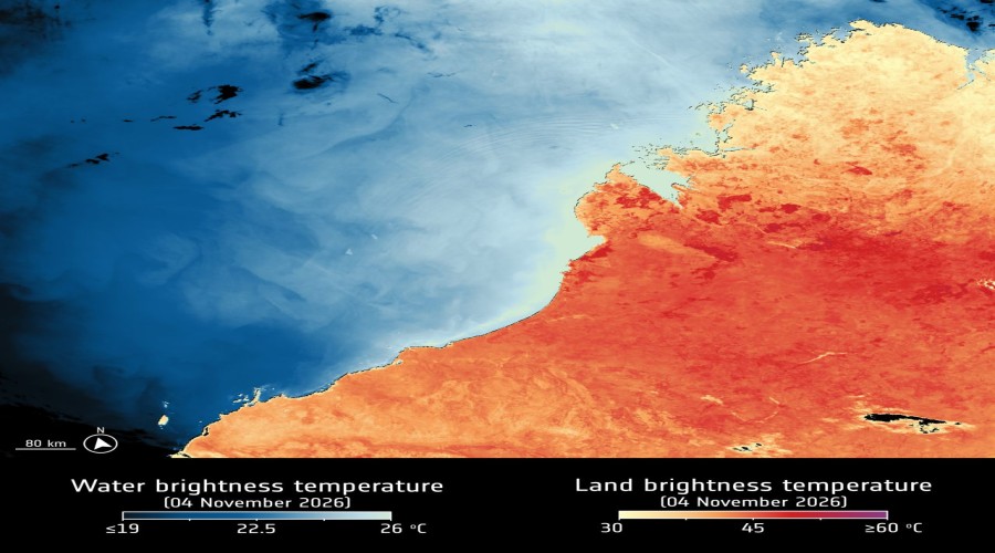
ESA Earth Observation Programmes and Head of ESRIN, said the satellite’s Sea
and Land Surface Temperature Radiometer had captured observations over Western
Australia and southwestern Europe and North Africa.
Alongside temperature
measurements, the first images include infrared and false-colour imagery
revealing vegetation and wildfire burn scars, demonstrating the range of
information the instrument can provide.
Cheli said the thermal
capability was particularly important not only for measuring land and sea
surface temperatures but also for monitoring wildfires through dedicated
detection channels.
She described the
development as an example of the European partnership behind Copernicus, which
brings together the European Commission, the European Space Agency and the
European Organisation for the Exploitation of Meteorological Satellites
(EUMETSAT).
Cheli said it was rewarding
to see another Copernicus satellite progressing towards operational service and
beginning to demonstrate the capabilities it will bring to Europe’s Earth
observation programmes.