Senegal signs space partnership with France at Paris Air show
Date: 2025-06-23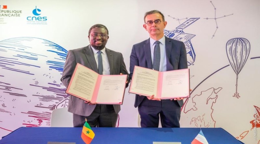
Senegal's Agence Sénégalaise d'Études Spatiales (ASES) and France's Centre National d'Études Spatiales (CNES) have signed a comprehensive space partnership. The agreement, signed at the Paris Air Show, positions Senegal as an emerging leader in African space technology through knowledge transfer and joint innovation.

ASES Director
General Maram Kairé and CNES President François Jacq formalized the
collaboration, which will focus on three strategic pillars: developing Earth
observation capabilities, cultivating local space industry talent, and creating
practical applications for sustainable development. The partnership directly
supports Senegal's national space strategy under President Macky Sall's
leadership, aligning space technology with critical needs in agriculture,
environmental monitoring, and infrastructure planning.
"This
agreement transforms Senegal from technology consumer to co-creator in the
space domain," declared Kairé during the signing
ceremony. "We're building more than satellites – we're developing the
expertise to harness space data for food security, coastal protection, and
urban development across West Africa."

The
collaboration will see French space experts working alongside Senegalese
engineers and researchers through exchange programs at Senegal's newly
inaugurated Diamniadio Space Campus. Initial projects include developing
microsatellite components and establishing a regional Earth observation data
hub in Dakar to monitor climate change impacts across the Sahel region.
CNES brings
five decades of technical expertise to the partnership, while ASES contributes
deep understanding of African development challenges. "This isn't
traditional North-South cooperation," noted Jacq. "We're
combining France's technical heritage with Senegal's innovation drive to create
solutions with pan-African relevance."

The agreement includes provisions for Senegalese startups to access CNES incubation programs, fostering a new generation of African space entrepreneurs. Early-stage collaborations will focus on using satellite imagery to optimize agricultural yields and track marine resources along Senegal's coastline.
By: Nana Appiah Acquaye