Ethiopia advances risk mitigation through geospatial research
Date: 2025-06-23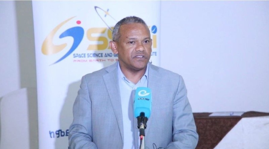
Ethiopia's Space Science and Geospatial Institute (SSGI) has taken a critical step toward national disaster preparedness by convening key stakeholders to review findings from its comprehensive National Landslide Vulnerability Mapping and Forecasting Study. The workshop brought together government agencies, researchers, and disaster management experts to translate geospatial data into actionable risk reduction strategies.

SSGI Director
General Abdisa Yilma noted the study's vital role in safeguarding vulnerable
communities during his opening remarks. "This research provides the
evidence base we need to prioritize interventions and allocate resources
effectively," he stated. "By identifying high-risk zones in
advance, we shift from reactive disaster response to proactive
prevention."
Lead researcher
Nathaniel Attane presented the methodology combining historical landslide data
with global modeling frameworks, revealing critical vulnerabilities in
Ethiopia's mountainous regions. The multi-layered analysis incorporated terrain
characteristics, rainfall patterns, soil composition, and human activity
factors to produce detailed risk assessments.

Workshop
participants proposed nature-based solutions including the strategic planting
of erosion-resistant vegetation and adapted agricultural practices for hillside
farming communities. "The integration of indigenous knowledge with
satellite monitoring creates sustainable mitigation approaches," noted
one agricultural expert during the technical discussions.
The forum
marked a milestone in Ethiopia's growing capabilities in applied space science,
demonstrating how earth observation technologies can address pressing
development challenges. SSGI plans to operationalize the findings through
collaboration with regional authorities and sector ministries, transforming
scientific insights into localized prevention measures.
By: Kanto Kai Okanto